
Virginia Drone Laws 2026: Shenandoah, DC Area & Rules Guide
 15 min read
2,833 words
15 min read
2,833 words
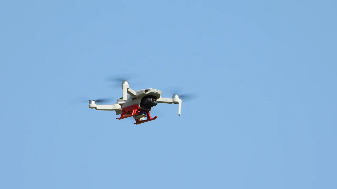
If you are a drone pilot in Virginia, you are operating in one of the most complex airspace environments on the East Coast. Virginia drone laws in 2026 are shaped by the overwhelming influence of the Washington, D.C., Special Flight Rules Area (SFRA), which covers a 30-mile radius and impacts every flight in Northern Virginia. This guide will walk you through the specific rules for Shenandoah National Park, Virginia Beach, state parks, and the critical no-fly zones around D.C., so you know exactly where you can and cannot fly.
You will learn the FAA’s federal baseline, how the D.C. SFRA affects your flight planning, and the specific restrictions for national parks, forests, and local landmarks. We also cover the permit process for state parks and the airspace considerations near Norfolk and Richmond. Whether you are a recreational flyer with a DJI Mini 4 Pro or a Part 107 commercial pilot, this guide provides the authoritative, up-to-date information you need for safe and legal flights in Virginia.
What Is the Federal FAA Baseline for Virginia Drone Operations in 2026?
All drone operations in Virginia must comply with the Federal Aviation Administration’s (FAA) baseline rules. These rules apply regardless of state or local ordinances. The FAA’s Part 107 governs commercial operations, while the Exception for Recreational Flyers covers hobby flights. Both require compliance with the same operational limitations.
Key federal requirements include: registration of any drone weighing over 0.55 lbs (250 grams) through the FAA DroneZone portal ($5 fee for three years), a remote pilot certificate for commercial use (Part 107), and adherence to the 400-foot altitude limit above ground level (AGL). You must also maintain visual line of sight (VLOS) with your drone and avoid flying over people or moving vehicles unless you have a specific waiver. The FAA’s B4UFLY mobile app is essential for checking airspace restrictions before every flight.
How Does the Washington DC SFRA Affect Northern Virginia Drone Laws?
The Washington, D.C., Special Flight Rules Area (SFRA) is the single most restrictive airspace issue for drone pilots in Northern Virginia. This 30-nautical-mile radius zone surrounds Ronald Reagan Washington National Airport (DCA) and covers all of Arlington, Alexandria, Fairfax County, and parts of Prince William and Loudoun counties. The SFRA is not just a no-fly zone; it is a highly regulated airspace with specific operational requirements.
Within the SFRA, drone operations are severely restricted. The inner core, known as the Flight Restricted Zone (FRZ), extends 15 nautical miles from DCA and is effectively a no-fly zone for all drones unless you have a specific FAA authorization, which is rarely granted for recreational flights. Even in the outer ring of the SFRA, you must obtain an airspace authorization through the FAA’s LAANC system before flying. This process requires a Part 107 certificate or a recreational UAS safety test (TRUST) and a LAANC-enabled app.
What Is the DC Drone Restricted Zone (FRZ)?
The Flight Restricted Zone (FRZ) is the most sensitive airspace within the D.C. SFRA. It is a 15-nautical-mile radius centered on Ronald Reagan Washington National Airport. This zone includes all of Washington, D.C., and extends into Arlington, Alexandria, and parts of Fairfax County. The FAA and the Transportation Security Administration (TSA) enforce a near-total ban on drone flights within the FRZ.
There are no recreational drone flights permitted in the FRZ. Even with a Part 107 certificate, obtaining authorization is extremely difficult and typically requires a specific security clearance and a detailed operational plan. The only exceptions are for government or law enforcement operations. If you live in or near the FRZ, you must check your location against the FAA’s airspace maps before every flight. Use our No-Fly Zone Checker to verify if your planned flight location falls within this restricted area.
What Areas Near Washington DC Can I Fly a Drone?
If you are in Northern Virginia, your options for legal drone flights are limited but not impossible. Outside the FRZ but within the SFRA (between 15 and 30 nautical miles from DCA), you can fly after obtaining a LAANC authorization. This applies to parts of Fairfax County west of the Beltway, Loudoun County, and Prince William County. You must use a LAANC-enabled app like AirMap or Kittyhawk to request real-time approval.
For areas completely outside the SFRA, such as the Shenandoah Valley, Richmond, and Virginia Beach, the airspace is less restrictive. However, you still face local restrictions like national park bans and state park permits. Always check your flight path against the FAA’s UAS Facility Maps, which show the maximum altitude allowed in controlled airspace. A typical approval in the outer SFRA might be 100 to 200 feet AGL.
Drone Rules for Shenandoah National Park and Other Federal Lands
Virginia is home to several federal land management areas, each with its own drone policy. The National Park Service (NPS) has a nationwide ban on drone takeoffs, landings, and operations within park boundaries. This applies to Shenandoah National Park, the Blue Ridge Parkway, and Colonial National Historical Park (including Jamestown and Yorktown).
Are Drones Allowed in Shenandoah National Park?
No. Drones are strictly prohibited in Shenandoah National Park. The NPS policy, established in 2014, bans all unmanned aircraft operations within park boundaries. This includes launching, landing, or flying a drone from any location within the park, including overlooks, trails, and campgrounds. The ban is enforced by park rangers, and violators face fines up to $5,000 and potential confiscation of equipment.
The reason for the ban is to protect wildlife, visitor safety, and the natural soundscape. Shenandoah is a popular destination for hikers and wildlife photographers, and drones can disturb black bears, deer, and nesting birds. If you want to capture aerial footage of the Blue Ridge Mountains, you must do so from outside the park boundary, on adjacent national forest land where drones are generally permitted.
Can I Fly a Drone on the Blue Ridge Parkway?
No. The Blue Ridge Parkway is managed by the National Park Service, and the same NPS drone ban applies. This means no drone flights are allowed along the entire 469-mile route that runs through Virginia and North Carolina. This includes all overlooks, picnic areas, and visitor centers. The ban is strictly enforced, and you cannot fly from the parkway itself or any adjacent NPS-managed land.
What About George Washington and Jefferson National Forests?
Unlike national parks, the U.S. Forest Service generally allows drone flights on national forest land, including the George Washington and Jefferson National Forests. These forests cover over 1.8 million acres in western Virginia and offer excellent opportunities for aerial photography of the Appalachian Mountains and Shenandoah Valley. However, you must follow all FAA regulations and avoid flying over wilderness areas, which have specific restrictions on motorized equipment.
You should also check for temporary flight restrictions (TFRs) due to wildfire suppression or wildlife management. Always land your drone immediately if you encounter wildlife or other visitors. The forest service does not require a permit for recreational drone use, but commercial operations may need a special use authorization.
Virginia State Parks: Do You Need a Permit to Fly a Drone?
Virginia State Parks have a specific drone policy that requires a permit for all drone operations. You cannot fly a drone in a Virginia state park without prior written authorization from the park manager. This applies to all 41 state parks, including popular destinations like First Landing State Park, Natural Bridge State Park, and Shenandoah River State Park.
The permit process typically requires you to submit a detailed flight plan, proof of insurance, and a description of your intended use. Permits are usually granted for educational, research, or commercial purposes, but recreational flights are rarely approved. Even with a permit, you must comply with all FAA regulations and avoid disturbing wildlife or other visitors. Contact the specific park office at least two weeks before your planned flight to request a permit.
Drone Rules for Virginia Beach and Coastal Areas
Virginia Beach is a popular destination for drone pilots, but the airspace is complex. The city itself does not have a specific ordinance banning drones, but you must comply with FAA airspace restrictions and local beach rules. The Virginia Beach resort area is within the Class D airspace of Naval Air Station Oceana (NTU), which requires LAANC authorization for flights.
Can I Fly a Drone at Virginia Beach?
You can fly a drone at Virginia Beach, but you must avoid the crowded resort area and follow specific guidelines. The FAA restricts flights over people and moving vehicles, so you cannot fly over the crowded boardwalk or beach during peak season. The best locations are the quieter sections of the beach, such as Sandbridge or the Back Bay National Wildlife Refuge area, but the refuge itself is a no-fly zone.
You must also maintain a safe distance from the Virginia Beach Oceanfront, which is a high-traffic area. The city has noise ordinances that may apply to drone operations. Always check the FAA’s B4UFLY app for temporary flight restrictions, especially during events like the Neptune Festival or air shows. For commercial flights, you need a Part 107 certificate and a LAANC authorization if flying near Oceana’s airspace.
Airspace Considerations Near Norfolk and Richmond
Virginia’s major cities have significant airspace restrictions due to military and commercial airports. Norfolk is home to Naval Station Norfolk, the world’s largest naval base, which creates a massive restricted area. Richmond International Airport (RIC) has Class C airspace that requires LAANC authorization for flights within 5 miles.
Naval Station Norfolk and the Norfolk Restricted Area
Naval Station Norfolk has a permanent restricted area (R-6606) that prohibits all drone flights. This zone covers the base itself and extends into the surrounding waters of the Elizabeth River and Hampton Roads. You cannot fly anywhere near the base, including the nearby areas of Portsmouth and Hampton. The military actively monitors this airspace and will intercept unauthorized drones.
Additionally, the airspace around Norfolk International Airport (ORF) is Class C, requiring LAANC authorization. The combination of military and commercial airspace makes the Hampton Roads region one of the most restrictive in Virginia. Use our Weight Checker to ensure your drone is properly registered before flying in this area.
Richmond International Airport (RIC) Airspace
Richmond International Airport has Class C airspace that extends 5 nautical miles from the airport. You must obtain LAANC authorization for any flight within this zone. The airspace is less complex than Northern Virginia, but you still need to check for temporary flight restrictions, especially during events at the Richmond Raceway or the Virginia State Fair.
For flights in downtown Richmond, you must also consider the altitude limits imposed by the airport’s approach paths. The typical LAANC authorization in this area might allow flights up to 200 feet AGL. Always check the FAA’s UAS Facility Maps for specific altitude caps.
Other Important Virginia Drone Locations: Colonial Williamsburg and the Appalachian Trail
Two other significant locations in Virginia have distinct drone policies: Colonial Williamsburg and the Appalachian Trail. Colonial Williamsburg is a private historical area, not a national park, so the NPS ban does not directly apply. However, the property is privately owned and managed by the Colonial Williamsburg Foundation, which prohibits drone flights on its grounds.
The Appalachian Trail (AT) in Virginia is a unique case. The trail passes through both national forest and national park land. On national forest sections (George Washington and Jefferson National Forests), drones are generally allowed. On national park sections (Shenandoah National Park), drones are banned. You must know exactly which jurisdiction the trail segment falls under before flying. The AT is also a designated National Scenic Trail, and the National Park Service has authority over its management, so always err on the side of caution.
Summary: Your Action Plan for Flying Drones in Virginia in 2026
Flying a drone in Virginia requires careful planning due to the dominant influence of the D.C. SFRA and the variety of federal and state land restrictions. Your first step is always to check your location against the FAA’s airspace maps. If you are in Northern Virginia, assume you are within the SFRA and need LAANC authorization. If you are near Shenandoah or the Blue Ridge Parkway, remember the NPS ban is absolute.
For state parks, contact the park manager for a permit. For national forests, you can fly freely but responsibly. Always register your drone if it weighs over 0.55 lbs, carry your TRUST certificate or Part 107 license, and use the B4UFLY app before every flight. The key takeaway is that Virginia’s drone laws in 2026 are a patchwork of federal, state, and local rules, and the D.C. SFRA is the single most important factor for pilots in the northern part of the state.
Frequently Asked Questions
Are drones allowed in Shenandoah National Park?
No, drones are strictly prohibited in Shenandoah National Park. The National Park Service has a nationwide ban on all unmanned aircraft operations within park boundaries. This includes launching, landing, or flying a drone from any location within the park, including overlooks, trails, and campgrounds. Violators face fines up to $5,000 and potential confiscation of their equipment.
Can I fly a drone in Northern Virginia near Washington DC?
You can fly a drone in Northern Virginia, but you must comply with the Washington D.C. Special Flight Rules Area (SFRA). If you are within 15 nautical miles of Ronald Reagan National Airport, you are in the Flight Restricted Zone (FRZ), which is a near-total no-fly zone. Outside the FRZ but within the 30-mile SFRA, you need LAANC authorization before every flight. Use the FAA’s B4UFLY app to check your location and request authorization.
What is the DC drone restricted zone?
The DC drone restricted zone, officially called the Flight Restricted Zone (FRZ), is a 15-nautical-mile radius around Ronald Reagan Washington National Airport. This zone covers all of Washington D.C. and extends into Arlington, Alexandria, and parts of Fairfax County. Recreational drone flights are completely banned in the FRZ, and even commercial Part 107 pilots face extreme difficulty obtaining authorization. The zone is enforced by the FAA, TSA, and Department of Defense.
Are drones legal at Virginia Beach?
Drones are legal at Virginia Beach, but with significant restrictions. You cannot fly over the crowded resort area or the boardwalk due to FAA rules about flying over people. You must also avoid Naval Air Station Oceana’s airspace, which requires LAANC authorization. The best locations are quieter sections like Sandbridge, but you must still check for temporary flight restrictions and local noise ordinances. Always maintain a safe distance from people and vehicles.
Can I fly a drone in Virginia State Parks?
You can fly a drone in Virginia State Parks only if you obtain a written permit from the park manager. The Virginia Department of Conservation and Recreation requires a permit for all drone operations, including recreational flights. You must submit a flight plan, proof of insurance, and a description of your intended use. Permits are typically granted for educational or commercial purposes, but recreational flights are rarely approved. Contact the specific park office at least two weeks in advance.
What areas near Washington DC can I fly a drone?
You can fly a drone in areas outside the 15-mile Flight Restricted Zone (FRZ) but within the 30-mile SFRA, such as parts of Fairfax County west of the Beltway, Loudoun County, and Prince William County. You must obtain LAANC authorization for every flight, which typically allows altitudes of 100 to 200 feet AGL. For areas completely outside the SFRA, like the Shenandoah Valley or Richmond, the airspace is less restrictive, but you still need to check for local restrictions like national park bans.
Last updated: June 25, 2026
- Federal Aviation Administration (FAA) — faa.gov
- National Park Service (NPS) — nps.gov
- Virginia Department of Conservation and Recreation — dcr.virginia.gov
- U.S. Forest Service — fs.usda.gov
Drone Allowed
DroneAllowed editor covering drone regulations, aviation law, and aerial photography across USA, UK, Canada & Australia.