
Cambridge University Drone Laws 2026: CAA Rules, The Backs & Where to Fly
 19 min read
3,678 words
19 min read
3,678 words
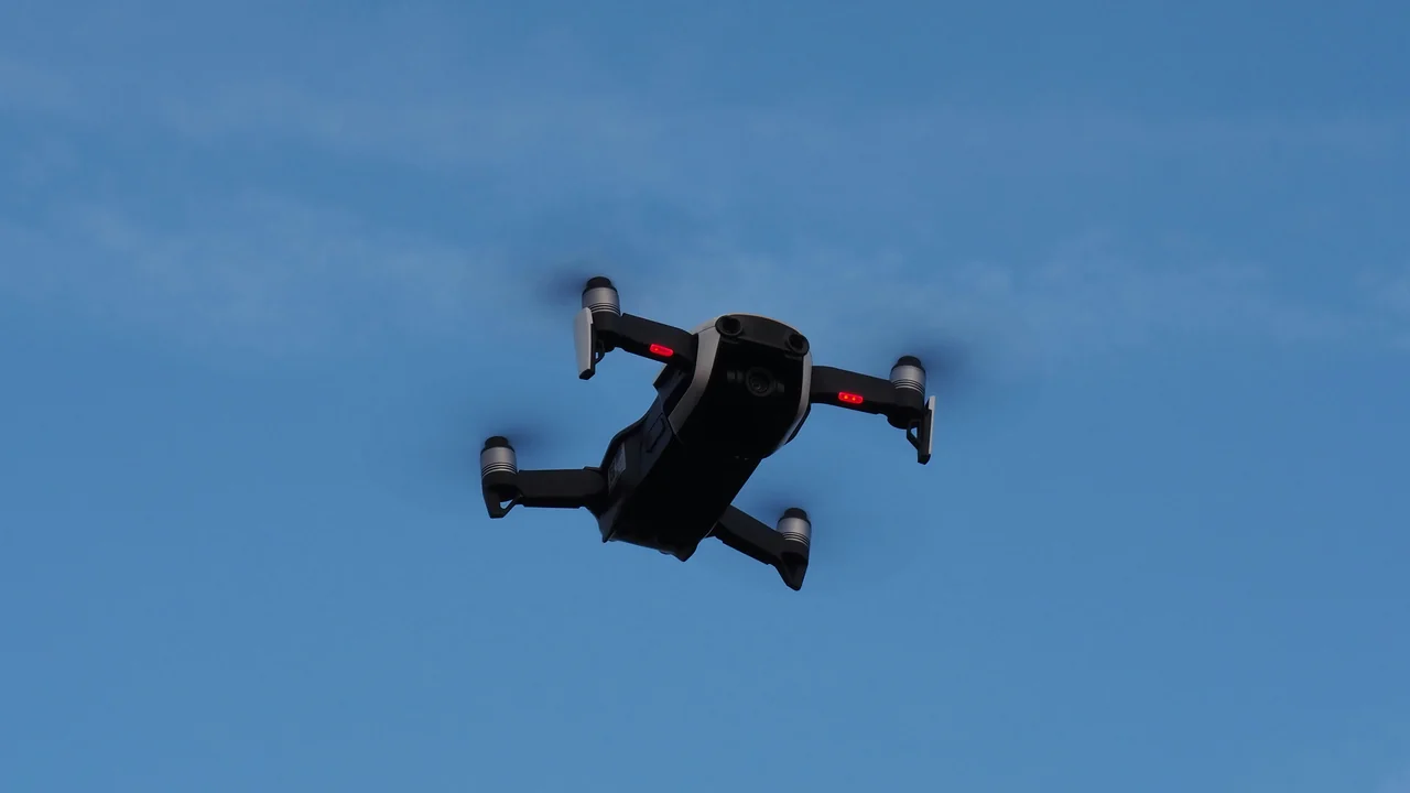
Flying a drone near Cambridge University is a dream for many aerial photographers, but the reality of Cambridge University drone laws is complex. The university is not a single campus but a federation of 31 colleges, each owning its land and controlling access, meaning there is no one-size-fits-all permission. In this guide, you will learn exactly where you can and cannot fly, how the Civil Aviation Authority (CAA) rules apply to the historic city centre, and how to navigate the airspace restrictions from Cambridge Airport to capture the iconic Backs and King’s College Chapel legally.
Do the CAA’s Standard Drone Rules Apply at Cambridge University?
Yes, the CAA’s Drone Code applies everywhere in the UK, including the airspace above Cambridge University. These are the baseline rules you must follow regardless of where you fly. The CAA regulates the airspace, not the land, so your legal obligations are determined by the drone’s weight, location, and proximity to people and structures.
For any drone weighing 250g or more, you must register as an operator and obtain a Flyer ID via the CAA’s online portal. The operator ID costs £9 per year and must be displayed on your drone. The Flyer ID is free but requires passing a short online theory test. For commercial operations or flying closer than 50 metres to people, you will need an A2 Certificate of Competency (A2 CofC).
The universal altitude limit is 400 feet (120 metres) above ground level, and you must always keep your drone in direct visual line of sight. The CAA also mandates that you do not fly over or within 150 metres of a congested area, and within 50 metres of any person, vessel, vehicle, or structure not under your control. This is where Cambridge’s unique layout becomes critical.
Understanding Cambridge University’s Unique College System for Drone Pilots
The University of Cambridge is a collegiate university, meaning its 31 constituent colleges are independent legal entities. Each college owns its buildings, grounds, gardens, and courtyards. Consequently, there is no central “university drone policy.” Instead, each college sets its own rules for what happens on its land. This is the most important concept for any drone pilot to grasp before flying near the university.
How to Get Permission to Fly Over College Grounds
To fly over a specific college, such as King’s, St John’s, or Trinity, you must seek permission directly from that college’s estates or security office. Most colleges will refuse recreational flights outright due to privacy concerns for students and fellows, and the risk of disturbance to academic life. For commercial filming, you may be granted permission, but expect a formal process involving liability insurance, a detailed flight plan, and a fee.
College grounds are private property. Even if you are standing on a public footpath, you cannot launch a drone from college land without permission. The CAA’s rules apply in the air, but the college controls the launch point and the airspace immediately above its land is subject to trespass laws if you infringe on their privacy or cause a nuisance.
Flying a Drone Near Cambridge University: Airspace and Airport Restrictions
Cambridge Airport (EGSC) is a Class D controlled airspace located just east of the city centre. This airport is active with general aviation, training flights, and occasional commercial operations. The Class D airspace extends from the surface up to 2,000 feet and has a radius of approximately 2.5 nautical miles from the airport. This directly affects the eastern parts of the university, including some colleges and the area around Parker’s Piece.
Most of the historic centre, including the Senate House and the University Library, sits just outside the Class D boundary, but the eastern colleges like Jesus College and Christ’s College are partially within it. Always check the live airspace map before flying. The No-Fly Zone Checker can help you identify restricted zones in real time.
Can You Fly a Drone Over The Backs in Cambridge?
The Backs is the iconic stretch of gardens and parkland behind the riverside colleges, including King’s, Queens’, St John’s, and Trinity. This area is college-owned land, not public parkland. The lawns, pathways, and riverbanks are private property belonging to each respective college. Therefore, flying a drone over The Backs requires permission from each college whose land you intend to overfly.
Even if you launch from a public footpath along the River Cam, the drone will inevitably pass over college gardens, which are private. The CAA’s 50-metre rule also applies to any people or structures below. During summer, The Backs are crowded with tourists and students, making it virtually impossible to maintain the required separation distance. The best advice is to avoid flying here unless you have explicit written permission from the relevant colleges for a commercial project.
Drone Rules for King’s College Chapel and King’s Parade
King’s College Chapel is a Grade I listed building and part of the Cambridge historic centre, which is a UNESCO World Heritage Site. Flying a drone directly over the chapel is prohibited by multiple layers of regulation. First, the college owns the building and its grounds, so you need their permission. Second, the chapel is a permanent structure surrounded by a congested area of pedestrian traffic on King’s Parade.
King’s Parade and Market Square are busy pedestrian zones, especially during term time and tourist season. The CAA’s rule prohibits flying within 50 metres of any person, vessel, vehicle, or structure not under your control. Given the density of people on King’s Parade, you cannot legally fly a drone there without maintaining a 50-metre bubble around every individual, which is practically impossible. Furthermore, the chapel itself is a structure, so you must stay 50 metres away from it. A drone flying overhead would be within this prohibited zone.
Where Can You Legally Fly a Drone Around Cambridge University?
Given the restrictions in the city centre, drone pilots should look to the open countryside surrounding Cambridge. The Fens, the vast flat agricultural land to the north and east of the city, offer excellent legal flying territory. This is Class G airspace, meaning you only need to follow the standard CAA Drone Code, with no additional airspace restrictions.
Grantchester Meadows, located south of Cambridge, is a popular spot. This area is outside the Class D airspace and is agricultural land with public access. However, be aware that it is a Site of Special Scientific Interest (SSSI) and part of the Countryside Stewardship scheme. While not a total ban, you should avoid disturbing wildlife and livestock. Always land immediately if animals show signs of stress.
| Location | Accessibility for Drones | Key Restrictions |
|---|---|---|
| The Backs (college gardens) | Very restricted | Private college land; permission required; 50m rule from people/structures |
| King’s College Chapel | Prohibited | Grade I listed; private land; congested area; 50m rule |
| River Cam (public sections) | Moderate | Public waterway; but adjacent college land; 50m rule from people on punts |
| Grantchester Meadows | Good | Outside Class D; agricultural land; avoid wildlife; SSSI considerations |
| The Fens (open countryside) | Excellent | Class G airspace; minimal restrictions; standard CAA rules apply |
| Wicken Fen NNR | Restricted | National Nature Reserve; no drone flights without Natural England permission |
Flying a Drone on the River Cam: What You Need to Know
The River Cam itself is a public waterway, meaning the water surface is not private property. However, the banks are owned by the colleges, and the airspace above the river is still subject to CAA rules. You can legally launch a drone from a public landing stage or a public footpath along the river, provided you are not on college land. The main issue is the density of punts and pedestrians.
During the summer, the river is crowded with punts carrying tourists. The 50-metre rule applies to every person on those punts. You cannot fly a drone within 50 metres of a punt, which makes flying along the river in the city centre nearly impossible. Furthermore, the river passes directly in front of King’s College and St John’s College, so your drone will be flying over their land. The safest approach is to avoid the river section between Jesus Green and Mill Pond entirely for drone flights.
Nearby Locations: Ely Cathedral and Wicken Fen
Ely Cathedral, located about 16 miles north of Cambridge, is another iconic structure. The city of Ely has its own local rules, but the cathedral is a Grade I listed building and a busy tourist attraction. The CAA’s 50-metre rule applies to the cathedral itself. Ely is outside Cambridge Airport’s Class D airspace, making it more accessible. However, you should contact the cathedral’s estates office for permission before flying overhead.
Wicken Fen National Nature Reserve (NNR) is a designated site of special scientific interest. Natural England, which manages the reserve, prohibits drone flights without prior written permission. The reserve is home to rare birds and insects, and drone noise can cause significant disturbance. Do not fly here unless you have an explicit permit. The surrounding Fens, however, are generally accessible for recreational drone flying.
Summary: How to Fly a Drone Legally Near Cambridge University
The key to flying a drone near Cambridge University is understanding the distinction between CAA airspace rules and private land ownership. The CAA controls the air, but the colleges control the ground and the airspace immediately above their property for privacy and nuisance reasons. For a recreational flight, your best option is to head to the open Fens or Grantchester Meadows, where you can enjoy the landscape without infringing on college privacy or violating airspace restrictions.
For commercial filmmakers, the process is achievable but requires planning. You will need an A2 CofC, full liability insurance, and written permission from every college whose land you intend to overfly. The No-Fly Zone Checker is an essential tool for verifying live airspace restrictions before any flight. Always check the Drone Assist app on the day of your flight to ensure no temporary restrictions are in place.
Is Cambridge Airport a problem for drone flying near the university?
Yes, Cambridge Airport (EGSC) is a Class D controlled airspace that covers the eastern parts of the city, including some college grounds. Flying a drone inside Class D airspace without prior permission from Air Traffic Control is a serious CAA violation. The airport’s airspace extends from the surface to 2,000 feet and has a radius of about 2.5 nautical miles. Always check the Drone Assist app or the No-Fly Zone Checker before flying near the university to ensure you are outside the controlled zone.
The Backs—the scenic area behind the colleges along the River Cam—is one of the most photographed spots in the UK. It includes the lawns, bridges, and gardens of King’s, Queens’, Clare, Trinity, and St John’s colleges. For drone pilots, this area presents a clear conflict: it is both highly desirable for aerial photography and strictly off-limits without explicit permission.
Under the CAA’s Drone Code, you must not fly over people, crowds, or built-up areas. The Backs is a public space that sees heavy foot traffic, especially during summer and graduation periods. Additionally, each college owns the land and buildings. Flying over The Backs means flying over private property without consent, which can lead to trespassing claims and confiscation of your drone by university security or the police.
What does this mean for your flight? You cannot legally launch from or fly over The Backs unless you have written permission from the relevant college estates office. Even then, you must comply with all standard CAA rules, including maintaining a 50m distance from uninvolved people and not flying over crowds. For most recreational pilots, the safest approach is to capture The Backs from a distance—such as from the opposite bank of the River Cam near the public footpath—provided you stay below 400ft and avoid flying over people.
King’s College Chapel is one of the most iconic landmarks in Cambridge. King’s Parade, the street running alongside the college, is a bustling pedestrian and vehicle route. Drone operations here are heavily restricted for several reasons: the building is a Grade I listed structure, the area is a crowded public space, and it falls within the Cambridge City Airport airspace.
The CAA rules explicitly prohibit flying over congested areas. King’s Parade is a congested area by definition—it is a street lined with shops, restaurants, and colleges, filled with pedestrians and traffic. Flying a drone here would violate the 50m distance rule from uninvolved people and the ban on flying over built-up areas. Furthermore, King’s College has its own policies prohibiting drone launches from its grounds without prior authorization.
If you want aerial footage of the chapel, consider using a telephoto lens from a legal distance—such as from the public park at Jesus Green or from a boat on the River Cam (subject to the river rules below). Always check the latest airspace restrictions via the NATS Drone Assist app, as temporary flight restrictions (TFRs) are sometimes placed over the chapel during events.
Finding a legal launch point near Cambridge University requires careful planning. The city center is almost entirely off-limits due to built-up area restrictions, airport airspace, and private property concerns. However, there are several locations on the outskirts where you can fly legally and safely.
| Location | Distance from City Center | Drone Suitability | Key Restrictions |
|---|---|---|---|
| Jesus Green | 0.5 miles north | Moderate | Open park, but near river traffic and pedestrians. Avoid flying over people. |
| Midsummer Common | 0.7 miles north | Good | Large open space. Keep below 400ft and away from livestock if present. |
| Coldham’s Common | 1.2 miles east | Excellent | Wide open fields. Outside controlled airspace. Best option for recreational flights. |
| Grantchester Meadows | 2 miles south | Good | Open grassland by the river. Check for nesting birds and livestock. |
| Cambridge Country Park | 3 miles west | Excellent | Dedicated open space. No airspace restrictions. Ideal for practice flights. |
For the best experience, head to Coldham’s Common or Cambridge Country Park. These locations offer wide open spaces with minimal pedestrian traffic and no airspace conflicts. From Coldham’s Common, you can capture distant cityscape shots of Cambridge’s skyline, including the chapel towers, without violating any rules. Always check local bylaws—some parks may have drone-specific prohibitions posted at entrances.
The River Cam flows through the heart of Cambridge and is popular with punts, rowing boats, and pedestrians along the towpath. Flying a drone over the river presents unique challenges. The river is a public waterway, but the airspace above it is still subject to CAA regulations, and the land on either side is private or college-owned.
You cannot launch a drone from a moving punt or rowing boat unless you have the boat owner’s permission and maintain full control. The CAA requires that you always keep your drone in visual line of sight (VLOS) and avoid flying over people. On a crowded summer day, the river is filled with tourists—flying over them is illegal. Additionally, the river passes directly in front of several colleges, meaning you would be flying over their private airspace.
Check the River Section
Only fly over sections of the Cam that are away from built-up areas, such as the stretch between Grantchester and the city boundary.
Launch from Public Land
Use public commons like Sheep’s Green or Coe Fen to launch. Never launch from college property or private gardens.
Avoid People and Boats
Maintain 50m distance from uninvolved people and 50m from boats. If the river is busy, postpone your flight.
Keep Below 400ft
The standard altitude limit applies. Stay well below tree line for safety and to avoid startling wildlife.
The River Cam is not a reliable location for drone flying during peak hours. Early mornings or off-season weekdays offer the best chance for a legal flight. Always have a spotter to watch for approaching punts or rowers, and be prepared to land immediately if the area becomes crowded.
If you are willing to drive 15–20 minutes from Cambridge, two excellent drone-friendly locations offer stunning subjects without the university’s restrictions: Ely Cathedral and Wicken Fen Nature Reserve.
Ely Cathedral Drone Rules
Ely Cathedral is a magnificent medieval structure located about 16 miles north of Cambridge. The cathedral itself is on private land, and you cannot fly directly over the building without permission from the Dean and Chapter. However, the surrounding area is less congested than Cambridge city center. You can launch from the public parkland near the cathedral (such as Cherry Hill Park) and capture wide-angle shots of the cathedral’s silhouette, provided you stay below 400ft and avoid flying over the building or the adjacent residential streets. Check the NATS Drone Assist app for any temporary restrictions, as the cathedral occasionally hosts events with TFRs.
Wicken Fen Drone Rules
Wicken Fen, a National Nature Reserve managed by the National Trust, is located about 10 miles northeast of Cambridge. Drone flying at Wicken Fen is heavily restricted. The National Trust prohibits drone flights over its properties without prior written consent, and Wicken Fen is a sensitive wildlife habitat. The reserve is home to rare birds, insects, and plant species. Flying a drone here can disturb nesting birds and is illegal under the Wildlife and Countryside Act 1981. Do not fly at Wicken Fen unless you have explicit permission from the National Trust for a specific project. Instead, visit the nearby Burwell Fen or Anglesey Abbey gardens (with permission) for alternative locations.
Flying a drone near Cambridge University is possible, but it requires strict adherence to CAA regulations and respect for college property. You cannot fly over college buildings, The Backs, or King’s Parade without permission. The airport airspace limits your altitude to 400ft and restricts flights near the runway. Your best options are the public commons on the city’s outskirts—Coldham’s Common, Midsummer Common, and Grantchester Meadows—where you can capture the skyline legally. For a more relaxed experience, drive to Ely Cathedral (with caution) or the Gog Magog Downs.
Always check the Drone Safe website and the NATS Drone Assist app before every flight. If you are a commercial pilot, consider applying for a CAA Operational Authorisation if you need to fly closer to the colleges for a specific project—but expect a lengthy approval process. For recreational pilots, the golden rule is simple: stay away from the historic core, launch from open public land, and never fly over people.
Frequently Asked Questions
Can you fly a drone at Cambridge University?
You cannot fly a drone over Cambridge University’s college grounds without explicit permission from each individual college. The university has no central drone policy; each of the 31 colleges controls its own land. For recreational flights, permission is rarely granted due to privacy and disturbance concerns. Commercial operators may obtain permission but must follow a formal process with liability insurance and a flight plan.
What is Cambridge University’s drone policy?
There is no single university-wide drone policy. The University of Cambridge is a collegiate institution, meaning each college sets its own rules for its grounds. The university’s central administration does not regulate drone flights over individual college land. You must contact the estates office of each specific college you wish to fly over. The CAA’s Drone Code still applies to the airspace above the university.
Can I fly a drone over King’s College Chapel?
Flying a drone over King’s College Chapel is effectively prohibited for recreational pilots. The chapel is a Grade I listed building on private college land, and the surrounding area, including King’s Parade, is a congested pedestrian zone. The CAA’s 50-metre rule applies to the chapel itself and to every person in the area. Without written permission from King’s College, a flight here would violate multiple CAA regulations and trespass laws.
Are drones allowed on The Backs in Cambridge?
The Backs are college-owned gardens, not public land. Drones are not allowed without permission from the individual colleges that own the land, including King’s, St John’s, and Trinity colleges. The area is also crowded with tourists and students, making it impossible to maintain the CAA’s required 50-metre separation distance from people and structures. Recreational flights over The Backs are not permitted.
Can I fly a drone on the River Cam?
The River Cam is a public waterway, but the adjacent banks are college-owned. You can launch from a public landing stage, but the drone will quickly fly over college land. The river is also heavily used by punts carrying tourists. The CAA’s 50-metre rule applies to every person on those punts, making it nearly impossible to fly legally in the city centre section. The safest option is to avoid the river between Jesus Green and Mill Pond.
Last updated: July 04, 2026
- Civil Aviation Authority (CAA) – The Drone Code
- NATS – Drone Assist App and Airspace Data
- University of Cambridge – Estates Division
- Natural England – Wicken Fen NNR Regulations
Drone Allowed
DroneAllowed editor covering drone regulations, aviation law, and aerial photography across USA, UK, Canada & Australia.